Difference between revisions of "Scalar fields\Export coordinate(s) to SF(s)"
Jump to navigation
Jump to search
| Line 5: | Line 5: | ||
== Description == | == Description == | ||
| − | This tool lets the user export the | + | This tool lets the user export the point coordinates to one or several scalar fields. |
CloudCompare will ask the user to select the source dimension(s): | CloudCompare will ask the user to select the source dimension(s): | ||
| − | [[Image:Cc_export_coords_as_SFs.jpg|frame|center|Edit > Scalar Fields > Export coordinate(s) | + | [[Image:Cc_export_coords_as_SFs.jpg|frame|center|Edit > Scalar Fields > Export coordinate(s) toSF(s) dialog]] |
Each dimension will be exported to a scalar field with a predefined name ('Coord. X', 'Coord. Y' and 'Coord. Z'). | Each dimension will be exported to a scalar field with a predefined name ('Coord. X', 'Coord. Y' and 'Coord. Z'). | ||
Latest revision as of 14:12, 23 February 2023
Menu
This tool is accessible via the 'Edit > Scalar fields > Export coordinate(s) to SF(s)' menu or the 'Tools > Projection > Export coordinate(s) to SF(s)' menu.
Description
This tool lets the user export the point coordinates to one or several scalar fields.
CloudCompare will ask the user to select the source dimension(s):
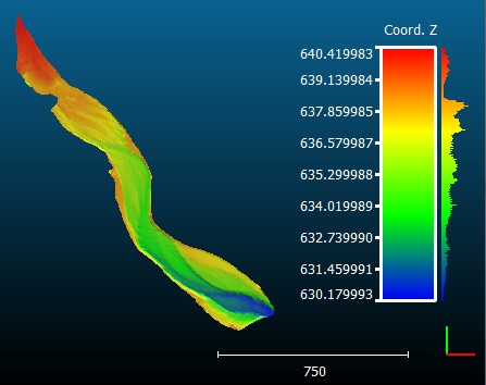
Each dimension will be exported to a scalar field with a predefined name ('Coord. X', 'Coord. Y' and 'Coord. Z').
Warning: if a scalar field with the same name exists, it will be overwritten.

